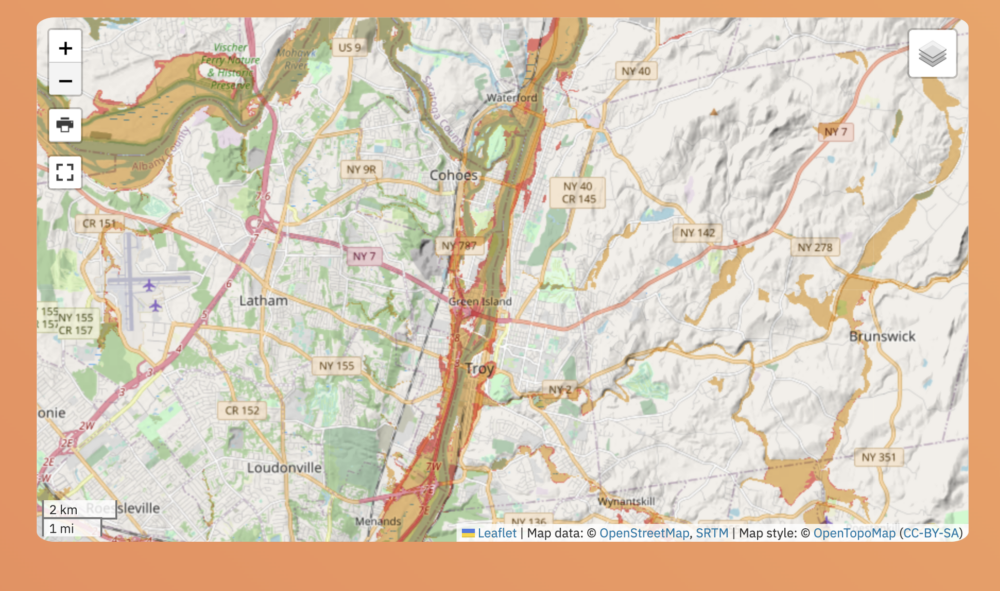
Flood Zones (yellow = 100 year flood plain, red = 500 year flood plain), source andyarthur.org (WMS Esri Map data)
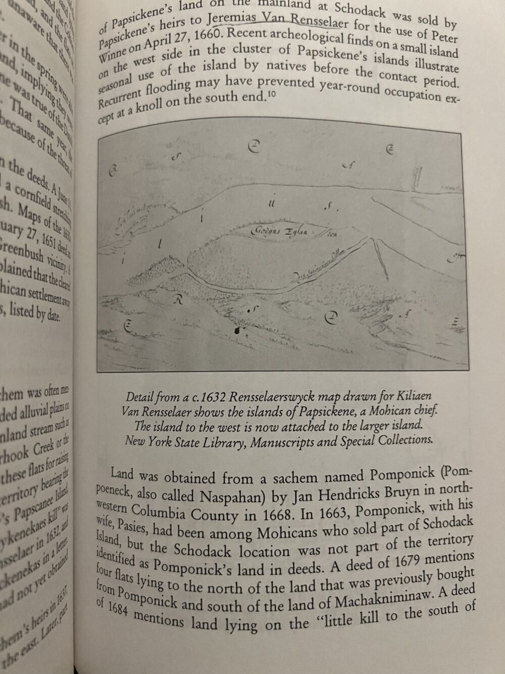
Historical maps from The Mohicans and Their Land (Shirley Dunn)
Historical maps from The Lansingburgh Historical Society
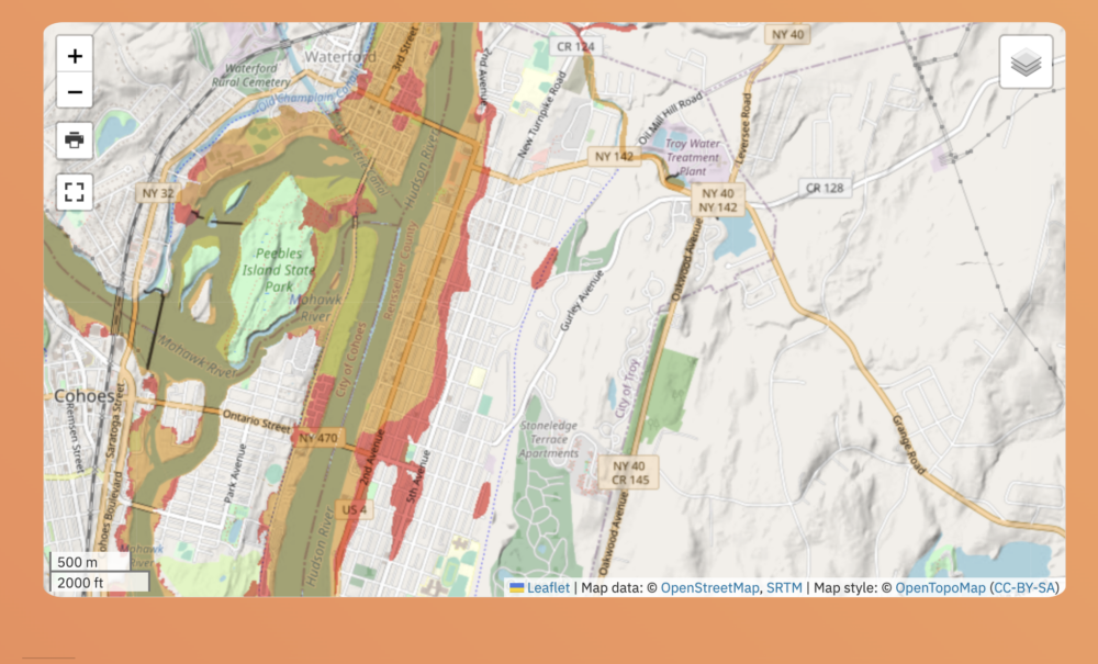
Flood Zones (yellow = 100 year flood plain, red = 500 year flood plain), source andyarthur.org (WMS Esri Map data)
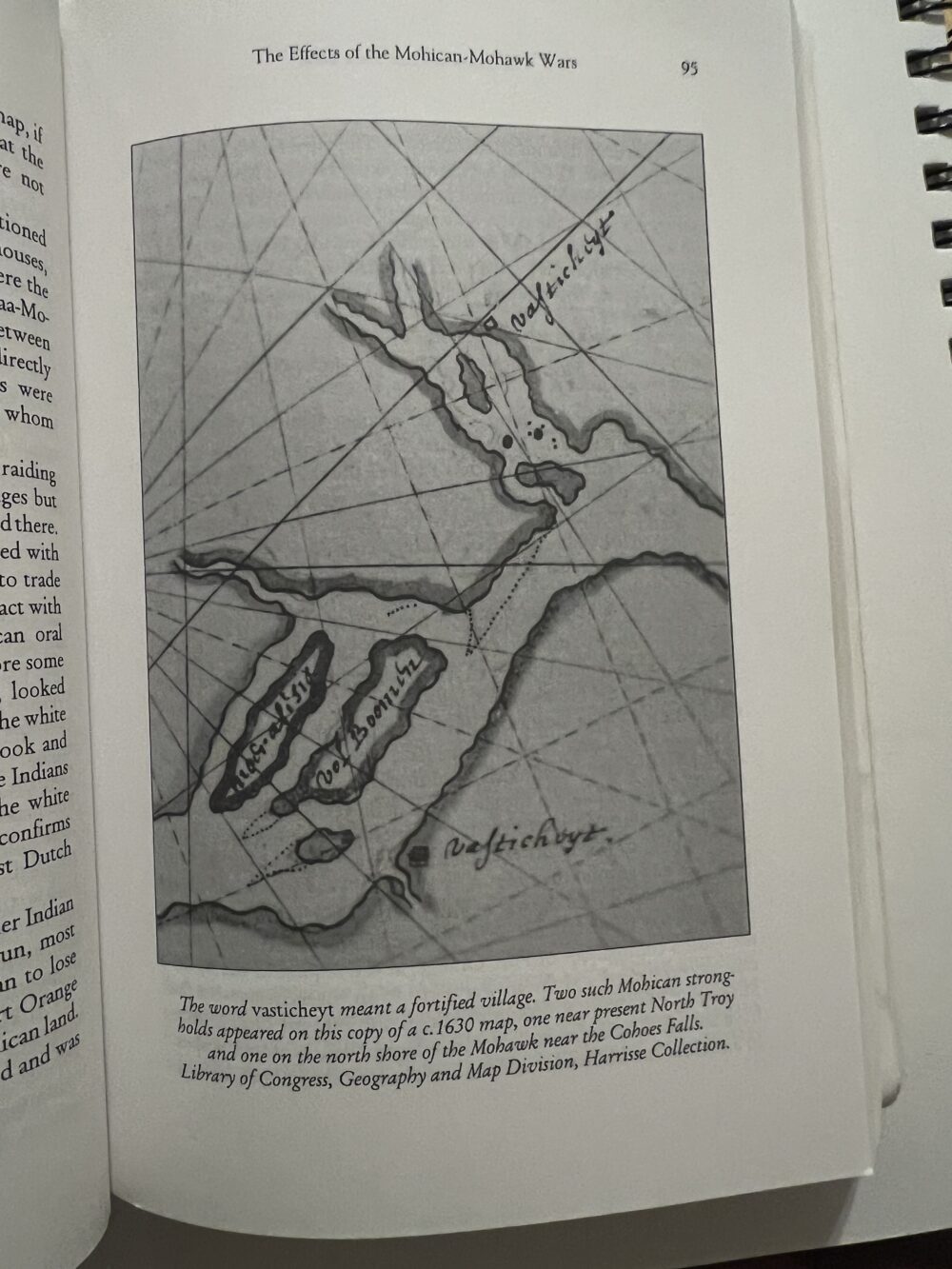
Historical maps from The Mohicans and Their Land (Shirley Dunn)
Historical maps from The Lansingburgh Historical Society